No closed database
The folder can live on your iPhone, iCloud Drive, or a compatible provider. Changing apps or devices never separates tracks from your files.

Giuzzi Lab for iPhone
Trekking · Hiking · Cycling · Motorcycling · Every other GPS-recorded activity
When the journey ends, GPXplorer Pro begins.
Your Files folder becomes a library with maps and diagnostics while documents stay where they are. With Pro, rediscover photos taken along the route, even years earlier, and explore automatic and cartographic markers. Waypoints let you keep the route’s important places in your GPX; the Edit section lets you split, extract, merge, and correct tracks.
Born from a real need
I built GPXplorer after years on the trail and on a motorcycle, with a growing track collection and dozens of apps tried. I wanted to understand and manage that collection without moving it into a closed system.
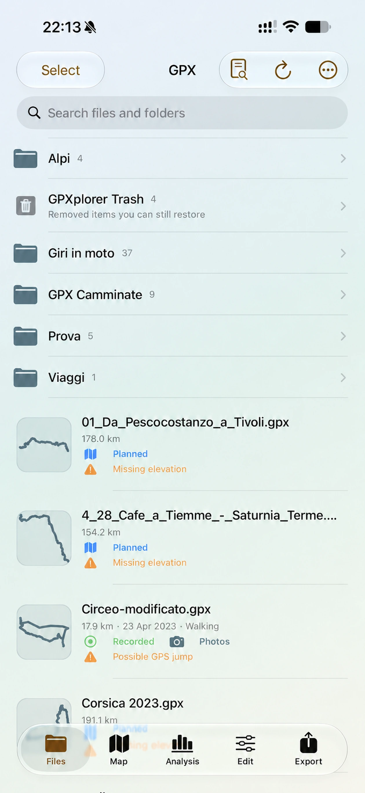
Connect a folder available in Files and see it inside the app with thumbnails, analysis, and dedicated tools. Documents stay where you put them, ready for other apps or devices too.
The folder can live on your iPhone, iCloud Drive, or a compatible provider. Changing apps or devices never separates tracks from your files.
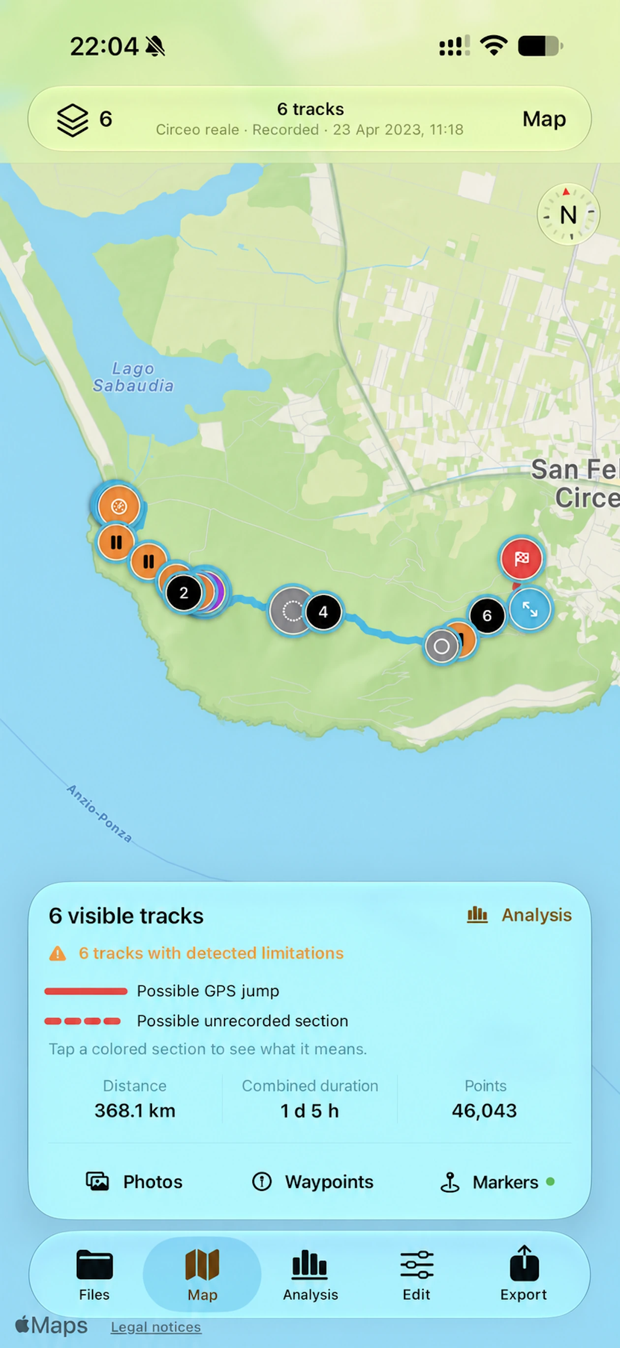
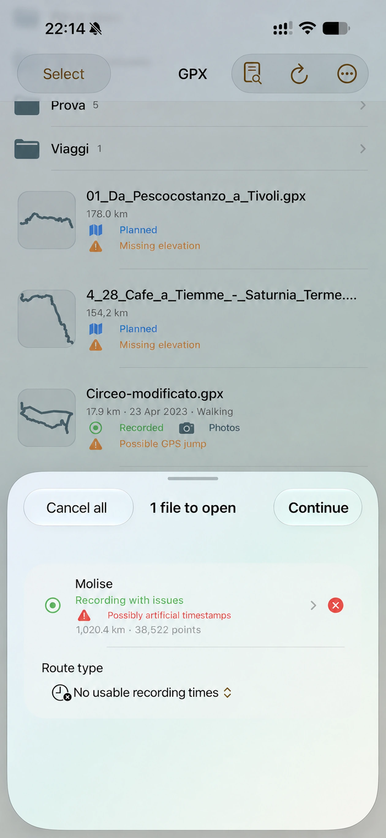
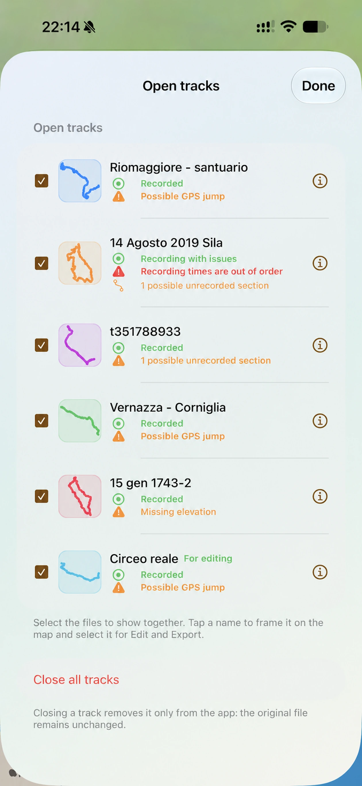
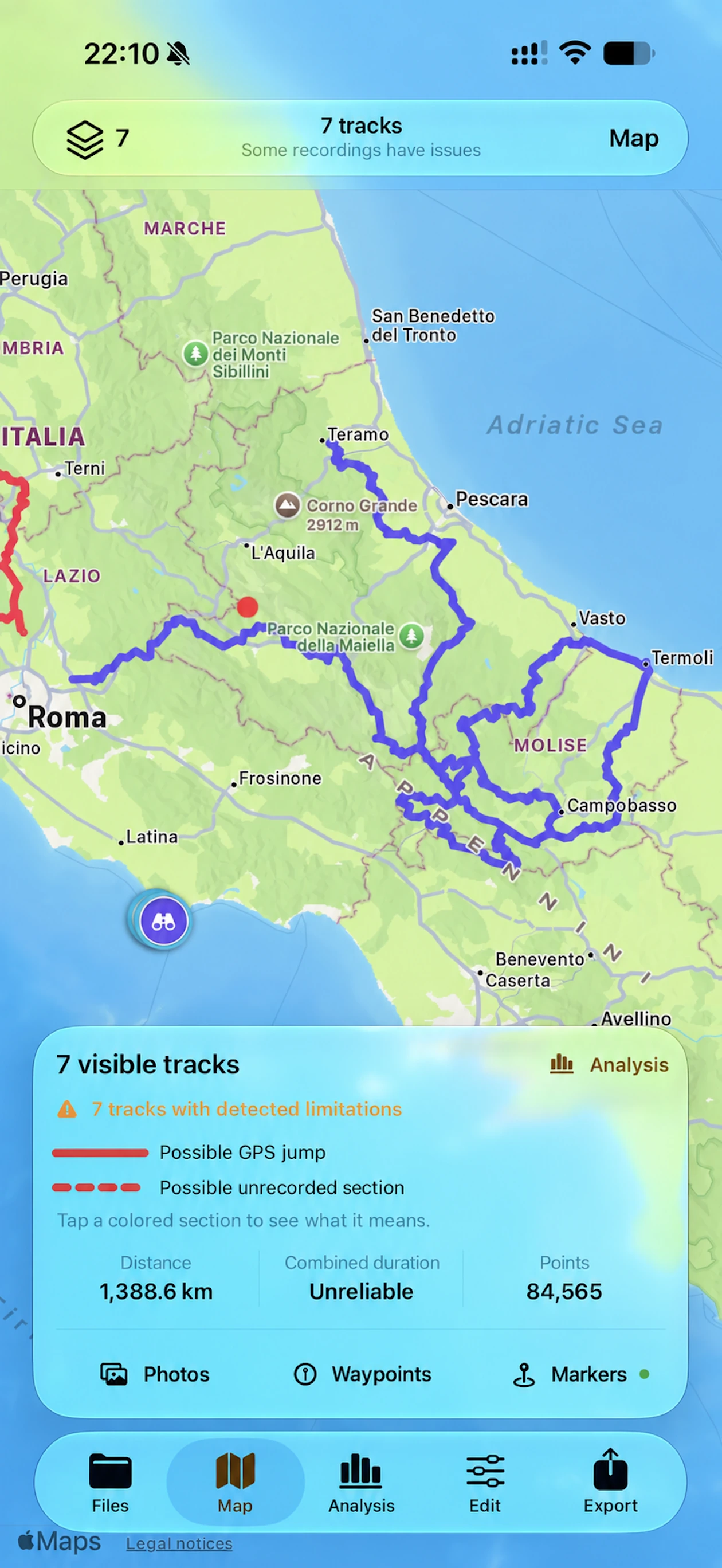
GPXplorer distinguishes recorded and planned tracks, detects position and time anomalies, and shows problematic sections on the map.
Every result is compared with the original to preserve details, metadata, and extensions—even data the app does not display.
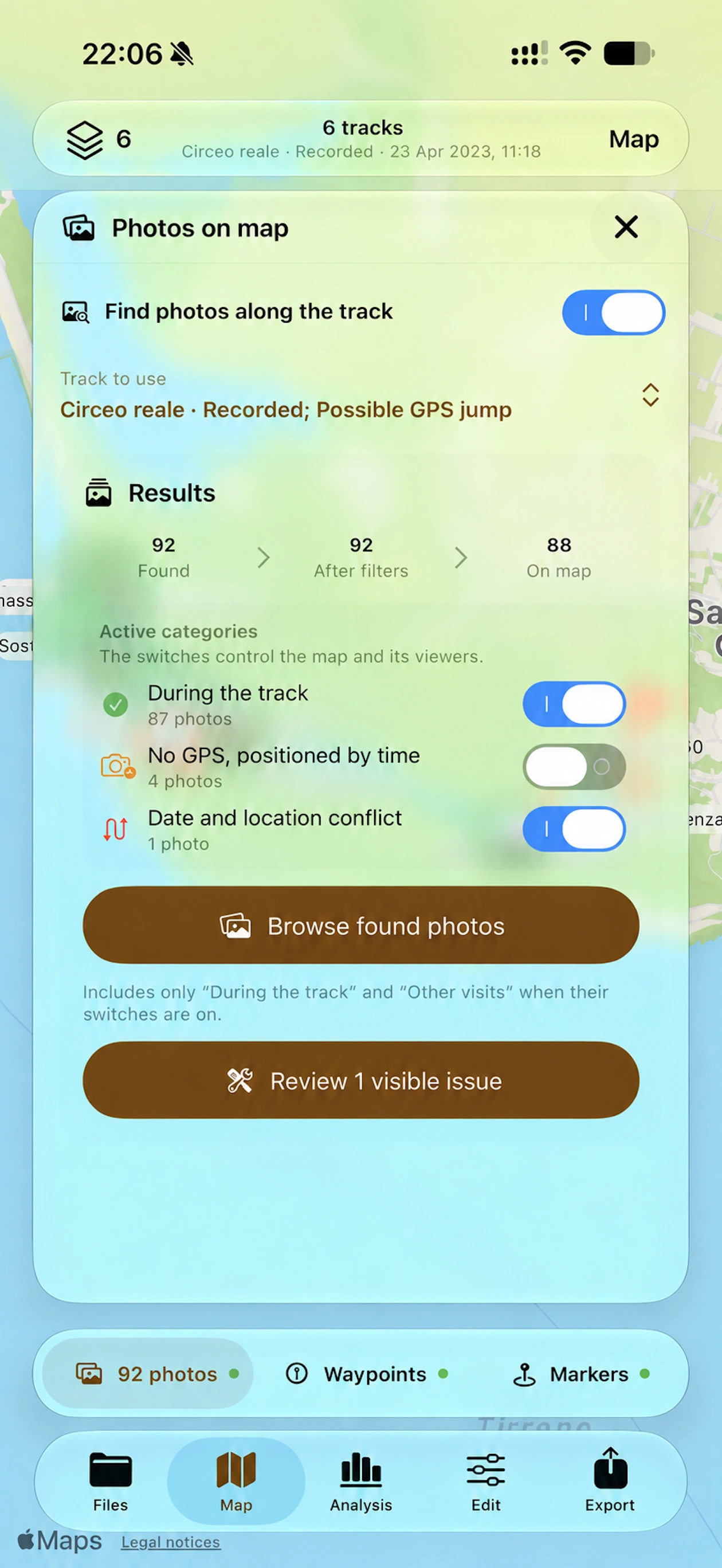
Find photos tied to the track and others taken in the same places months or years earlier, revealing the route across different moments.
Keep the route’s important places as waypoints: add them from the map or create them from automatic and cartographic markers, then export them in your GPX.
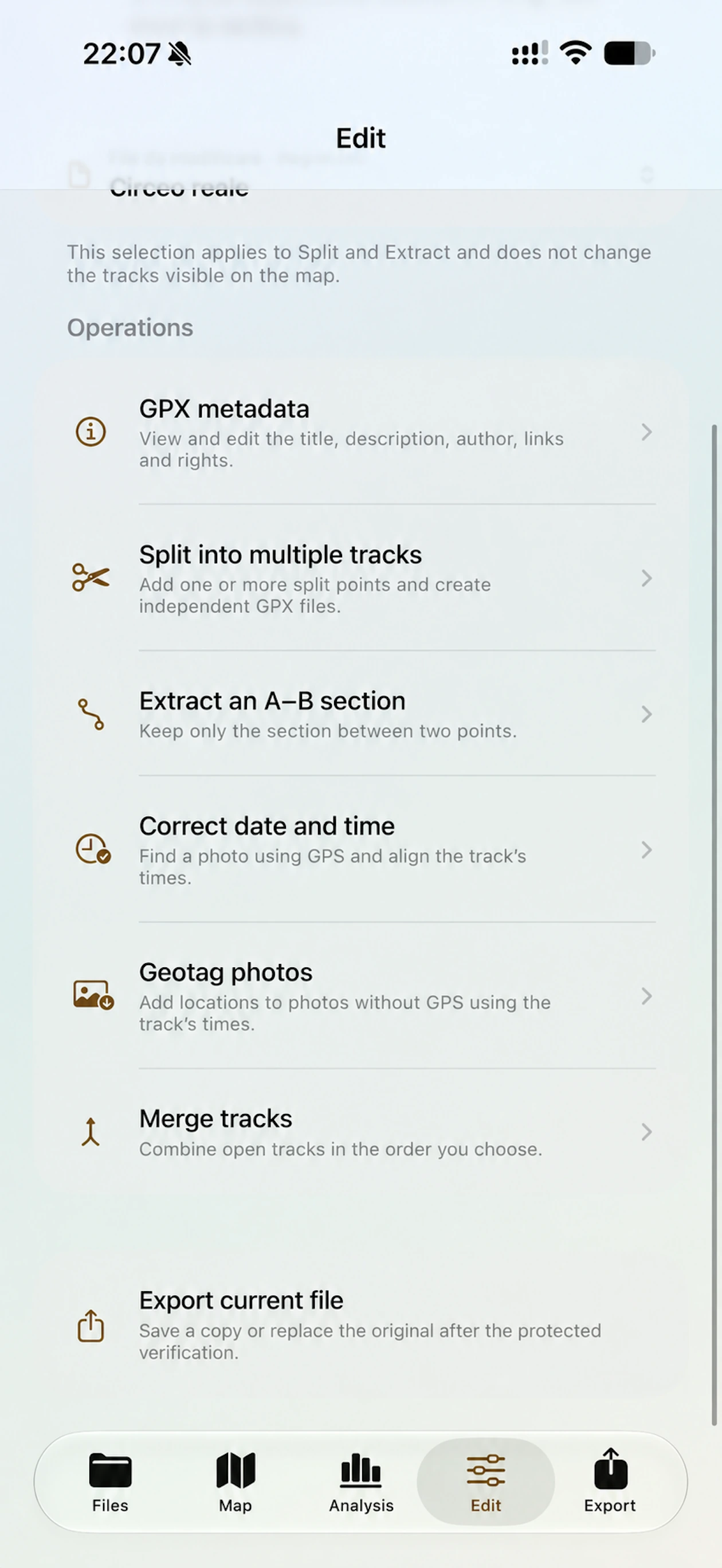
Split, extract, or merge tracks, edit metadata, correct the timeline, and geolocate photos. Choose how to save the result after export verification.
Photos and mapping
GPXplorer connects the track, your photos, and the landscape. It shows not only where you went, but helps reconstruct when, under which conditions, and with which memories.
Search combines date, time, and position to find both photos from the outing and images taken along the same route at other times.
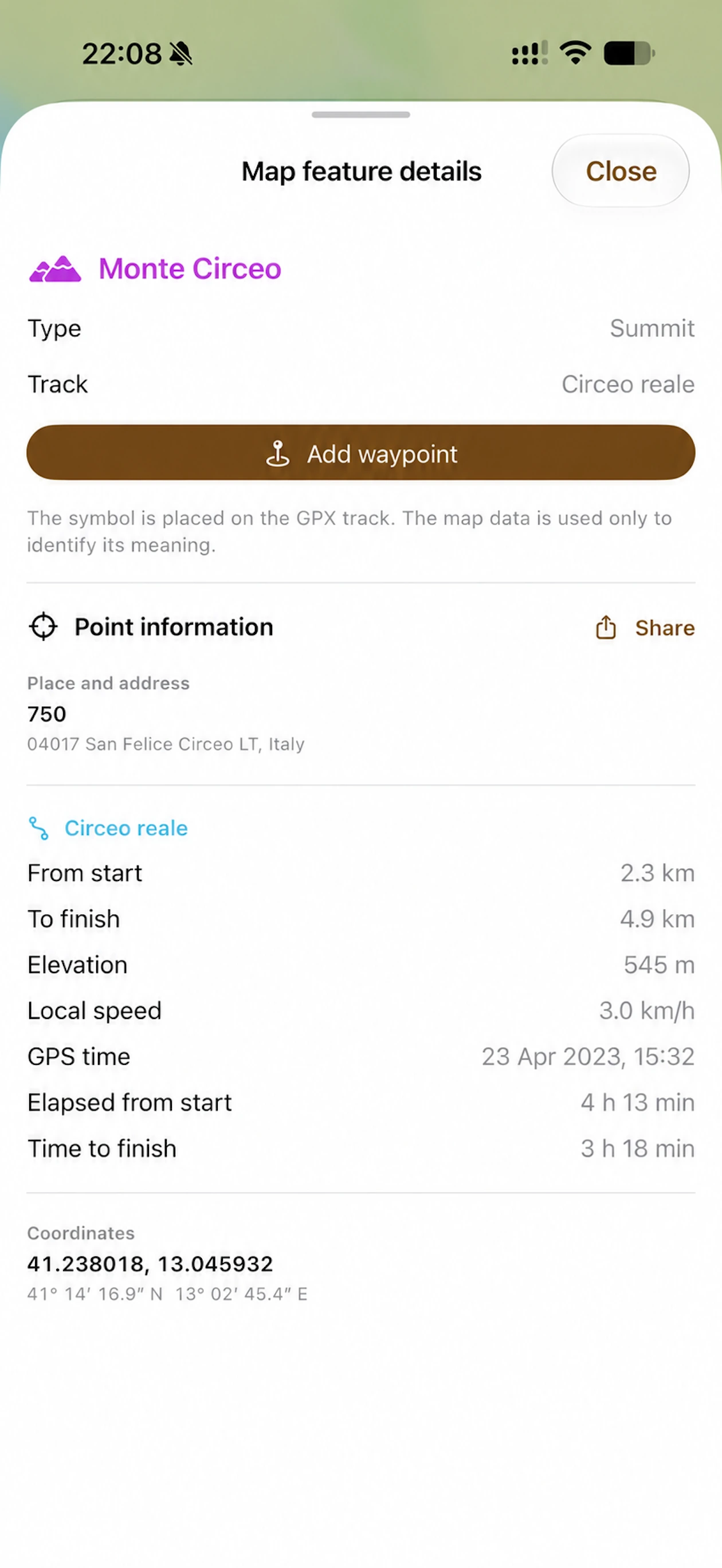
Automatic markers describe the route; cartographic markers add OpenStreetMap context.
Automatic markers · Pro
GPXplorer finds reference points in the track: start, finish, stops, elevations, distances, and times. With Pro, choose which markers to show, explore their details, and turn the ones you want to keep into waypoints.
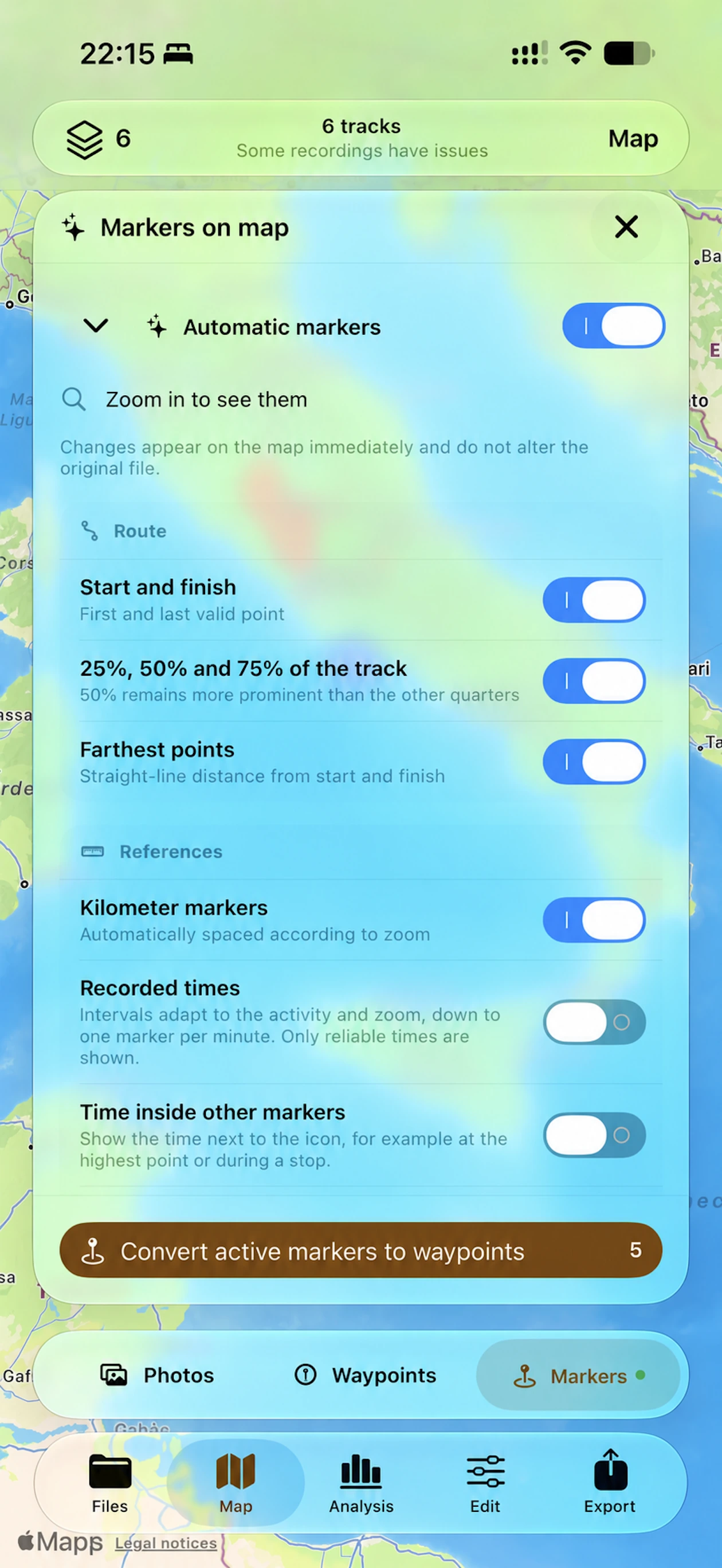
Locate the first and last valid points, 25%, 50%, and 75% of the route, and the point furthest from the start and finish. The halfway marker stays more prominent than the other quarter points.
Enable distance references, which become less frequent as you zoom out, and time references, whose intervals adapt to the activity and zoom level. Times appear only when reliable; you can also show them beside other markers.
Find stops, the highest and lowest points, and gradient and speed references. Markers connect the track’s data to specific places along the route.
Enable the categories you need and zoom in to see the markers. Settings immediately change the map view; to keep markers in your GPX, turn active markers into waypoints and export the result.
Waypoints · Pro
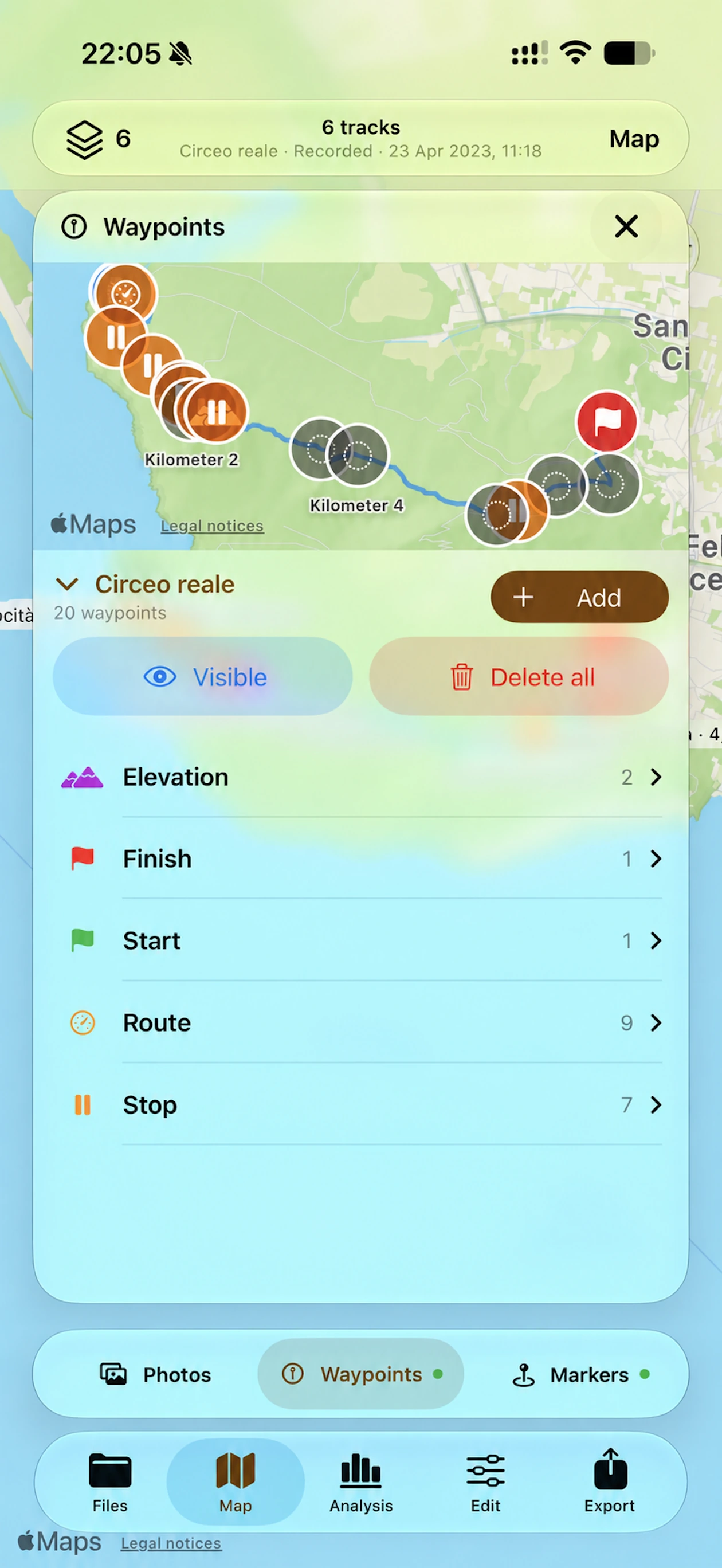
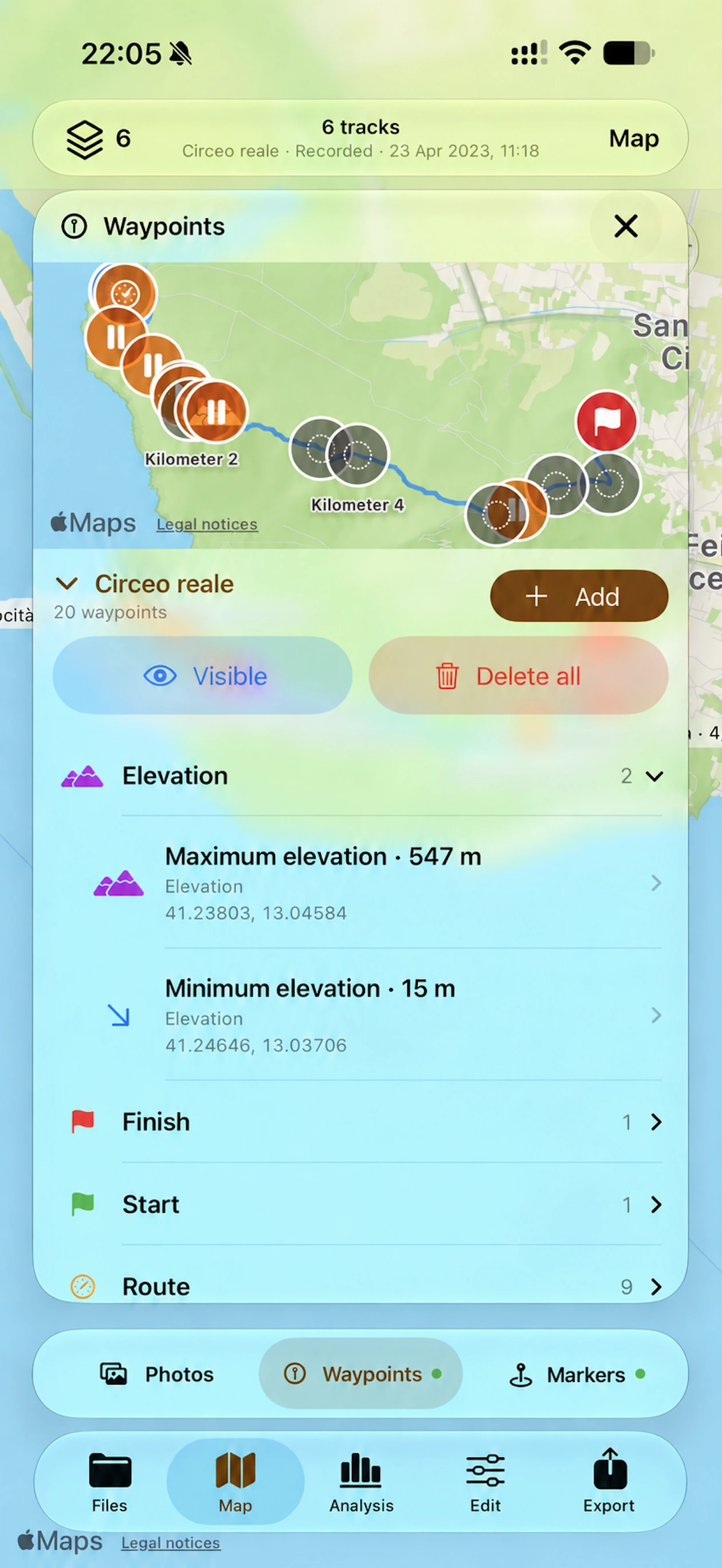
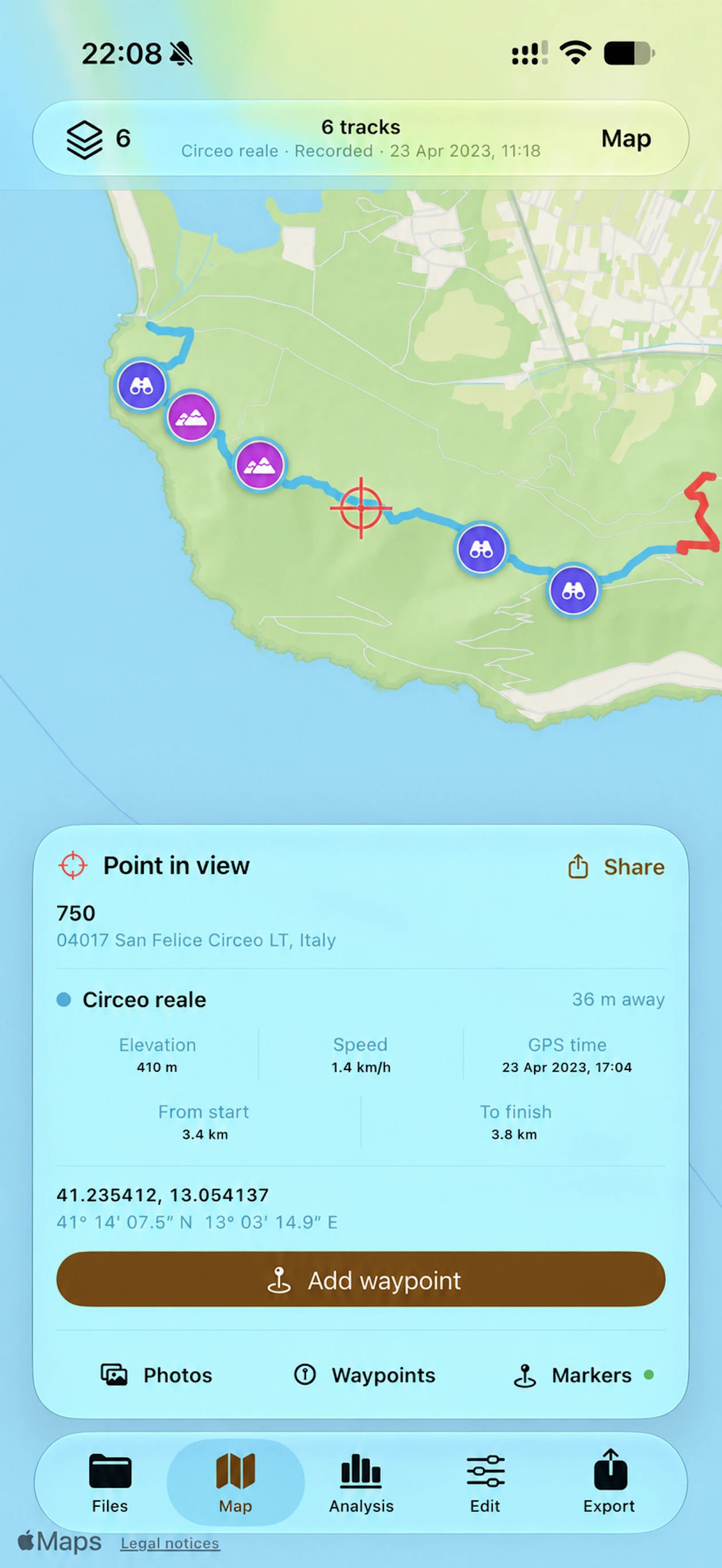
A stop, a summit, or a viewpoint: waypoints are reference points you can keep with your route. GPXplorer Pro shows them on the map and organizes them by category, so you can find them again and take them with you in the exported GPX.
Browse track waypoints grouped by elevation, start, finish, route, and stops. Expand a category to see individual points and their coordinates, and choose whether to show them on the map.
Use the crosshair to frame a place and add a waypoint, or start from a cartographic marker’s details. Coordinates, elevation, and distances along the track help you understand where it is.
Turn active markers into waypoints: start and finish, distance references, stops, and other significant points can become references saved in the file when you export.
GPX editing · Pro
A track that is too long, several stages to combine, or a recording whose times need correction: GPXplorer Pro’s Edit section gives you tools to work on the GPX and prepare a result for export.
View and edit the title, description, author, links, and rights: give the file a useful name and context for finding and sharing it.
Add one or more cuts and create independent GPX files. Separate the stages of a trip or different parts of an outing.
Choose two points and keep only the route between them, to isolate a walk, a climb, or a section to share.
Find a photo using GPS and use it as a reference to realign the track’s times when the recording’s timeline needs correction.
Add a location to photos without GPS using the track’s times, so you can find the images where they were taken.
Combine open tracks in the order you choose, to reconstruct a route split across recordings or bring several stages into a single file.
Editing prepares the result before saving. Export is checked against the original to preserve compatible details, metadata, and extensions. Save a copy, or choose to replace the original file after the protected verification.
Inside the app
The folder becomes a visual library; each track opens into maps, analysis, photos, markers, waypoints, and editing tools.
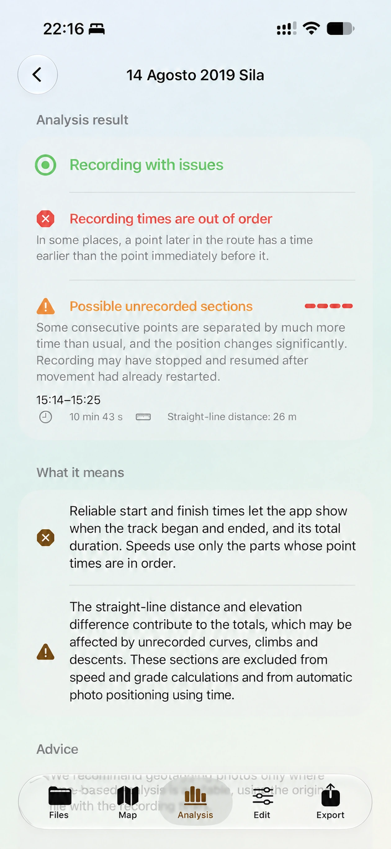
Advanced diagnostics
Every problem is flagged and explained. When it can be located, GPXplorer highlights the affected section on the map and adapts statistics to the actual quality of the data.
Two editions
GPXplorer and GPXplorer Pro are separate apps. There are no subscriptions or in-app purchases.
For managing files and folders, comparing tracks, and understanding how reliable they are.
For working deeply with tracks through photographic memory, terrain, and advanced editing.
Current availability and pricing for GPXplorer Pro are shown on its App Store page.
GPXplorer requires no account, includes no advertising, and uses no tracking systems.
Parsing, statistics, quality checks, markers, transformations, and export verification all happen in the app.
Maps and some features depend on the services selected by the user.
In the folder you choose in Files, on your device, in iCloud Drive, or with a compatible provider. GPXplorer presents it as a library without importing documents into an internal database.
Transformations prepare a separate version. When you export, the result is verified: save a copy, or choose to replace the original file after the protected verification.
The result is compared point by point with the original file to retain compatible metadata, details, and extensions, including data the app does not directly manage or display.
The app omits metrics that cannot be calculated reliably, such as when usable timestamps or elevation data are missing.
No. GPXplorer and GPXplorer Pro are separate apps, with no subscriptions or in-app purchases.
GPXplorer’s local data is removed. Files stored in external folders and photos in your library remain in place.